Saturday, October 15, 2011

Part 1: Torbay


The Northeastern Avalon Peninsula

As the last part of our adventures outside of St. John's we decided to hit the North East tip of the Avalon Peninsula. As very little planning accompanied this chapter of the trip we were content with letting chance play a role, and as a result we probably had more fun not knowing what to expect. I will chronicle this part of the trip in four parts to spread out the photos and keep me focused on the description and narrative.

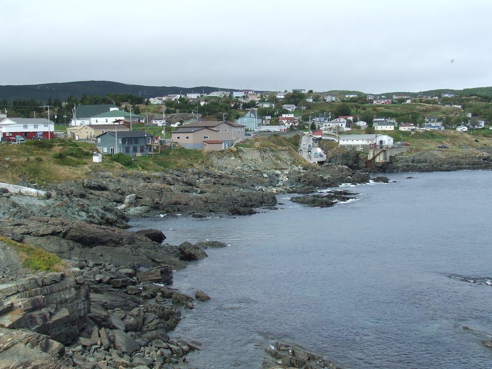
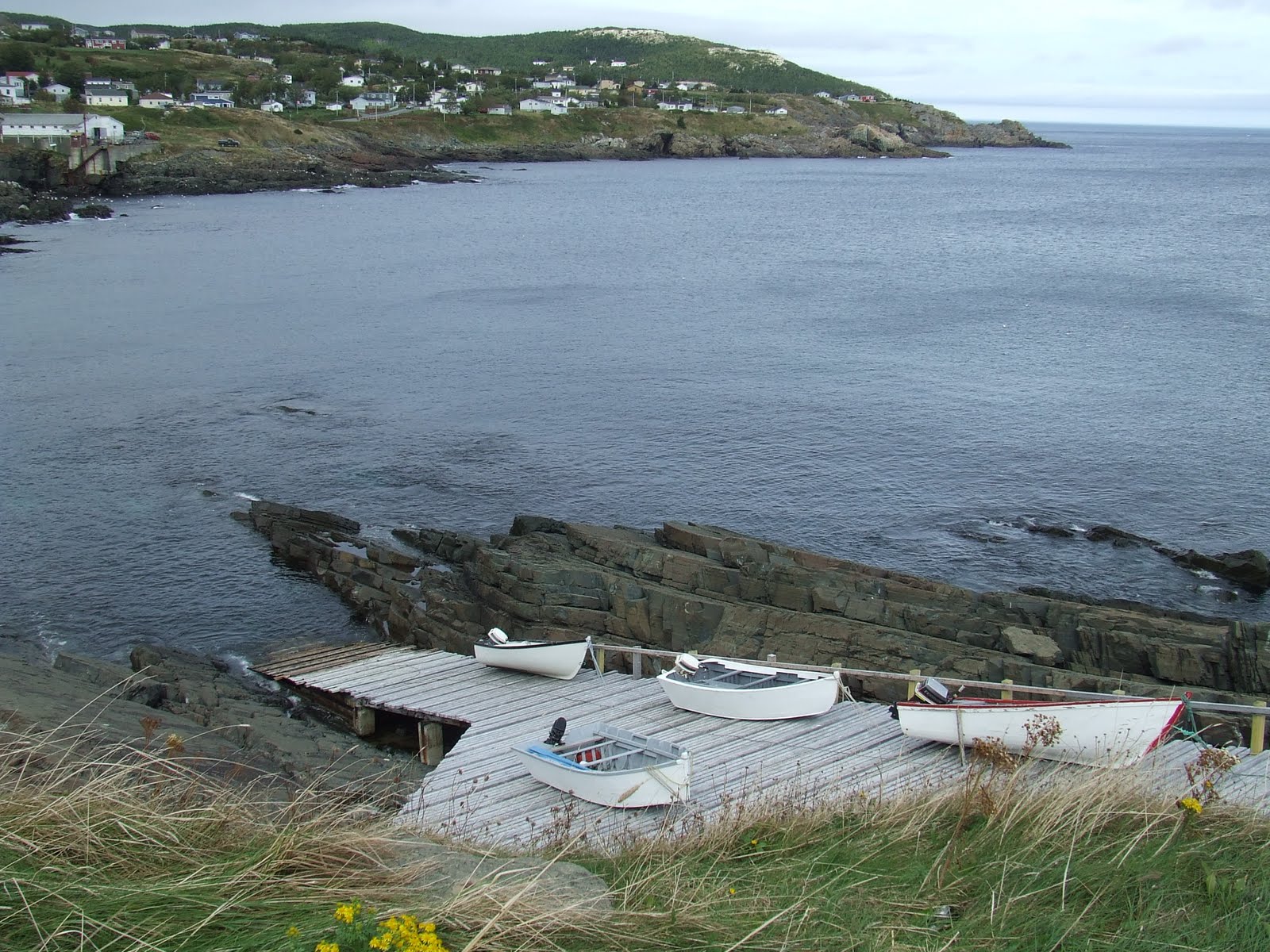
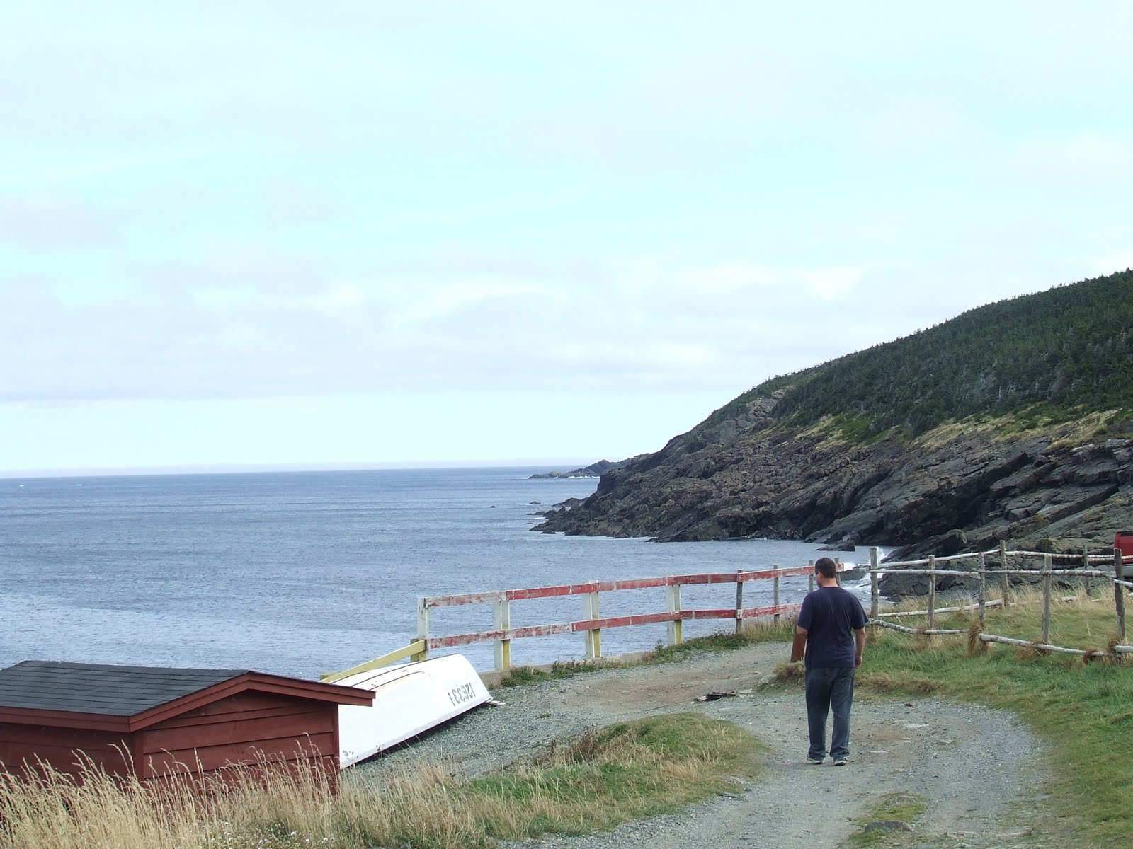
The ocean views from the shores of Torbay were captivating. The area was more open and vast than previous stops in the Avalon. It sported many rocky cliffs and scattered boats. Most of these boats were small, anchored and abandoned. By chance we took an off road detour from the highway and found a fishing pier. A small group of fishermen were at work. Jay and I had the opportunity to speak with this one very cool angler who allowed us to photograph him while filleting one of his catches. He shared with us that prior to the moratorium he used to take in 1500 lbs of cod per day and now he can only legally catch 5 fish a day. Even facing these restrictions he still chooses to brave the ocean waters in his tiny boat and toil for full mornings just to meet his quota. Again like his peers (no pun intended), this man harboured no resentment. he just seemed content to keep up the tradition as fruitless as it may seem to us. The little village captured on the face of the cliff in one of the pictures must surely be the homes to this last group of fishing soldiers.

Part 2: Pouch Cove


When you travel this area you can often come upon a village unannounced or miss it entirely if you don't know what seemingly unimportant road to take tot he hidden village. Fortunately a sign of the next town came in the form of its local pharmacy. Being a little thirsty Jay and I decided to stop. After snapping a shot of the store's sign we went in and were greeted by a wholesome mother daughter team. What truly beautiful people. Their opening question was 'hope you don't mind me asking why you took a picture of our sign?' I answered that their sign would be helpful to me later when reviewing my photos and would signify when the Pouch Cove photos begin. They both seemed amazed and pleased. We asked them what kind of photo opportunities we could expect in the cove and they both seemed surprised that we would even consider taking pictures of their town exclaiming that there wasn't much to see there. Instead they urged us to take in the village of Bauline. This turned out to be great advice. I think they were sad to see us leave.

Although they were right about Bauline they could not have underestimated their own village more. What must have once been a very busy cove was now diminished to two flats of small boats tied down to an inclined dock (apparently called a slipway) that climbed a treacherous drop from the highway to the shore (see pictures). Jay and I noticed the sad posting from the Pouch Cove Harbour authority. Notice the paltry $25 annual docking fee. We guessed that in its heyday the harbour would have surely taken in hundreds to thousands each season from each vessel.

Part 3: Bauline


At the advice of the fine residents of Pouch Cove we left the areas circling the the northern tip en route to Bauline. On the way we caught our first experience of the infamous Newfoundland fog. Although it was in no way obstructing our views its effects cast a welcomed improvement to the scenery. The fog hung so impressively over a grave yard that it merited a photo. The embedded photo does not do it justice. Before reaching the small community we came upon Bauline's harbour. Notice the very well worn sign of L' Argents Atlantic Ltd. It's keeper, we affectionately named Willie, was a very interesting looking character. He walked with a serious sideways limp, as though one leg was shorter than the other. While we watched him, he transitioned from the old chair of his small workstation to greet a small vessel of fisherman. As he walked over we started to understand how his limp may have come to be. The dock was slanted in the same direction as his limp. I wondered to myself how many times he walked this 100-150 yards route. Hazards of the profession I guess. Check out the character in this face. I had to capture this from afar, as I did not wish to interfere with the ceremony.

After this we made are way to the residential part of Bauline. Not unlike any other little village in Newfoundland this one sported colourful proud looking houses build on uneven ground. Being right at the edge of the ocean this one was more beautiful and scenic than most. We experienced two boys playing soccer literally feet from the ocean cliff, residents out for a two minute stroll tot he neighbours and a shirtless older man splitting wood. The shirtless man probably provided the biggest laugh of the whole trip. Although it is sure to be one of those 'you had to be there' moments, lets just say our brief wordless interaction scared the bejesus out of us and signaled the end of the Bauline experience for us.

Part 4: Portugal Cove and Conception Bay


This rather uneventful detour took quite a bit of time. We were not sure where Portugal Cove officially began but sure knew where it ended. The harbour looked upon Bell Island and this port seemed busier and more productive that than most. Bell Island was quite distinguished off in the distance and the people were few and far between. There was no human interactions in for us in Portugal Cove just pretty scenery.

Knowing this was likely the last of our site seeing travels and being tired from our day of driving, we head back to St. Johns.

Friday, October 7, 2011

The Avalon - Irish Loop


The first three pictures are the view from Witless Bay. We stopped at its Ecological centre and ventured into the village. In the village we stopped into an art gallery that housed some very intricate but over priced pulled rugs. The two folks in there were very helpful and convinced us to continue through the village to some popular vantage points. The Red house and tree that overlooks the ocean is a popular post card and tourist promo shot of the area. After that we were told to make our way to Ferryland. We stopped at the visitor centre which you will see from afar in photo number 4. Ferryland was all but a ghost town closed for the season. The visitor centre patron told us we would find a restaurant or two in Trepassey. Before we took off for Trepassey we found the first beach front setting since we landed and took the opportunity to put our hands in the ocean. The beach front was stone, and I took a few for the girls. Although I am not sure, I think this must have been Renews or Cappahayden.

Before we could get to Trepassey we found a tourist welcoming centre for the touristy Cape Race. I think this was technically in Portugal's Cove South. The seemingly lonely lady that stood shop here was helpful but insistent that I take a quick walkthrough the modest museum. While I sacrificed myself feigning as much interest as I could, Jason found the ship wreck map that would become the catalyst to our wedding gift to Ian.

In Trepassey, finding the restaurant was a breeze. It was the only place that showed any form of life. That life came in the form of one car in the parking lot. Inside we found the owner of that car. The sole diner that accompanied Jason and I was a retiree named John. John was a St. Stephens native who just a few years ago had returned to his birthplace after 40 years of working for Ontario Hydro. He would not stop talking. We found out that he was very familiar with our neck of the woods and like all Newfoundlanders he was well versed in all the OHL hockey lore. He was a proud community member of the Avalon Peninsula. He lamented the areas decline from prosperity with us and told us stories of the Portuguese fishing raiders. Although you could tell his history left an indelible mark on him, he harboured no resentment for those that contributed to the decline of his homeland. Not the sailors and even not the federal government that betrayed these folks with botched politics. When John returned to the area he purchased a house for next to nothing and while remodelling over a period of a few years he dined at that restaurant three times a day, every day. Talk about loyalty. When the owner emerged with his full garbage bag of partridge berries you could sense they were like family. With the Partridge berries came another sad story of how breakfast food chains from the US had devoured that berries once fertile market for the production of pancake topping syrups. John was our personal glimpse into the heritage and history of the area. He, like all of Newfoundland's people is (along with the scenery) the last of the area's great standing treasures and a highlight of our trip. After a great meal, another highlight, we headed off to St. Vincent. Or so we thought.

Before we came to St. Vincent we travelled through St. Stephen's (John's hometown). Although there was nothing more than a corner store/gas station to see here, we took special notice due to our fondness for John. John told us with a few expletives how that very morning he was forced to drive into Trepassey as the aforementioned store was out of F'n bread. Incidentally this store is another casualty of the area’s economics, as the ex-school teacher and her daughter who lived there and ran the operations were packing up and moving onto more prosperous pastures.

Before we could find St. Vincent we crossed a long man-made road that cut through an inlet of water which must have been Harboured Pond. Very soon after, we finally fell upon St. Vincent which proved to be another stretch of vacant looking houses stuck together like a bland oasis in the middle of a vast desert. This scape fancied a vast shoreline of tiny stones that crescented the most southerly point of a blotch of glued together houses. That's Jason and I (in separate pics) standing at the edge of where the roads would no longer take us. We were followed by a curious four wheeling female, who without even a wave or word of welcome roared as close as she could to investigate; as would some species of wildlife, who the spun around kicking up gravel and disappeared into the distance as quickly as she came.

From here there were not many highlights of note. We passed through St. Mary's without incident, after which we traversed 30 or so kilometres of interior land on Hwy 90. The land was beautifully scenic and cut though some small bodies of water with forested cliffs. We ran into our first signs of ominous looking and tormented skies. We kept our eyes peeled for the moose that typically ventured onto the roads at this time of day. We passed a family fishing off the side of the road with what looked like a very large catch. We would have loved to stop and take pictures but it felt too intrusive. One last highlight came as a lucky break when I caught out of the corner of my eye a small pond on a road side property that boasted a man-made miniature village built around it. It was quite fascinating and intricate. See the picture above.

The tail end of the trek was uneventful and soon we hit the TCH that took as back to St. John's with a promising night on the town.

Monday, October 3, 2011

Cape Spear


Facts and History:
Cape Spear is traditionally considered to be the easternmost location in North America.
The Portuguese named this location "Cabo da Esperança" which means "cape of hope", which became "Cap d'Espoir" in French and finally "Cape Spear".
Because of its proximity to convoy routes during the Second World War, a gun battery was installed at Cape Spear to defend the entrance to St. John's harbour. Barracks and underground passages leading to the bunkers were built for the use of troops stationed there.
The lighthouse is the oldest surviving lighthouse in Newfoundland and the location has been designated a Canadian National Historic Site.

Log:
The first part of our journey to and through the peninsula was not without its challenges. Finding (or getting to) Petty Harbour and Cape Spear was not easy for us. After tearing ourselves away from Petty Harbour we made our way to Cape Spear. Remaining weary of the posted warnings to stay clear of the rocky shore (due to unpredictably and bonafide lethality) we took our time taking in what is probably the penultimate view of the Atlantic known to man. After walking the perimeter and watching the crashing waves we made our way to the battery and underground bunkers. I must first note that we now wonder how dramatically different this violent shore must have been a few days later when hurricane Ophelia hit the region. After a brief planking incident we made our way to the famed lighthouse. My gimpy companion braved the treacherous wooden legion of stairs to the summit of Nfld`s earliest surviving lighthouse. Without the ability to explore inside the white and red structure, a lighthouse is really just a lighthouse. The view from it was however another whole thing. Conscious of the time we lost getting to our first two stops, we absorbed this for a while and hit the road again in direction of the Irish Loop.

Petty Harbour


Both Jay and I unanimously thought that Petty Harbour was the most interesting place we visited in Newfoundland. It combined great locals, history, a beautiful scenic community, surrounding cliffs and a unique harbour front and view of the ocean.

In the pictures you will find pictures of each. We took a detour driving up a narrow road that winded up the cliff face. We were nervous that the car would not make it and smelled burning which we hoped would not result in a burned out transmission of the rental car. At the top of the cliff we found of all thing a basketball court. And beyond the court we found a cemetery that boasts the greatest view I have ever seen. This setting left the tombstones weathered and clinging to existence (leaning and often protected with barriers) The people laying underneath these stones suffered similar fates at the hands of the elements with many young adults and children are resting here. Only a hand full of surnames marked those stones. Chafe, Stack and Everard's who have once indubitably ruled the shores of Petty Harbour.


Note the following definition: harbour(s); a haven or space of deep water so sheltered by the adjacent land as to afford a safe anchorage for ships. This is a perfect description of Petty Harbour.


Some history and facts. population of 950. The site has been continuously occupied since at least 1598, predating the arrival of the Mayflower and making it one of the oldest European settlements in North America. It is nestled deep in the heart of Motion Bay. Due to its beauty it has been the setting for many films and stories. My dad's favourite movie Orca was filmed there.


We met a young guy at a pub in St. John's later one night. This guy was full of life and good cheer. His spirit indicative of a true Newfoundlander. With little effort or intention he made all of us visitors reevaluate how we look at life. He was also from Petty Harbour. Go figure.